
Nashville Neighbors Block Sources
Nashville neighbors research uses records that describe a block from different angles. The Nashville Parcel Viewer shows individual parcel geometry and map context. The Assessor adds owner and tax fields. Recorded deeds document instruments and party names. Historic city directories can establish a dated listing, while Metro neighborhood links identify public community contacts. No one source provides an authoritative roster of every person on a block.
| Source | What it shows about a block | Access |
|---|---|---|
| Nashville Parcel Viewer | Adjacent parcels, current-owner field, land use, ZIP, district, and map context | Public viewer with a daily-update notice and accuracy disclaimer |
| Metro Assessor | Parcel ID, situs and mailing context, value, sales, and exemptions | Public search by address, owner, or parcel |
| Register of Deeds | Recorded instruments, grantors, grantees, and legal descriptions | Modern index begins July 1, 1964; older materials need archive routes |
| Metro Archives | Dated households, maps, directories, and local history | Collection-specific repository access |
| Metro neighborhood links | Public civic, association, chamber, and community contacts | Not a membership roster |
The useful result is a sourced block picture: what parcel is beside another, which record dates apply, and which public community route is available. It is not a claim about a household's day-to-day life.
Map Nashville Neighbors From One Parcel
Start by entering the precise address in the Parcel Viewer. Its core search modes include parcel address or intersection, current owner, street name, and custom shape. The map can then be used to inspect nearby parcels and its result table can be printed or exported. Record the parcel identifier and distinguish each parcel's situs address, current owner, tax mailing information, and history before making a comparison.
- Find the starting address or parcel in the Viewer and save the parcel ID, ZIP, and map position.
- Inspect immediately adjoining parcel boundaries, one at a time, instead of treating a street or subdivision as a single record.
- Check the Assessor or recorded instrument for the relevant role and date.
- Use a dated directory or map only when a historical question requires it.
- Keep a note of the source URL, access date, geography label, and any mismatch.
Adjacent ownership is a block-context clue, not a resident list. A parcel can belong to a trust, company, estate, or a person receiving tax notices elsewhere. The approach protects the difference between legal ownership and household presence.
Nashville GIS Layers Around a Block
The Nashville Parcel Viewer offers advanced fields for parcel ID, owner name, street, description, city, ZIP code, acreage, sale dates and prices, zoning, overlay district, land use, council district, and tax district. Its detail and history tabs document ownership, property, zoning, assessment, and permit information. Tools include table printing and export, all-permit viewing, measurements, drawing, coordinates, imagery, and street view.
A Parcel Viewer search supplies the geographic layer for a Nashville neighbors inquiry.
- Parcel
- A legal or tax unit of land, which may not align with a household.
- Situs address
- The mapped address of taxable property, distinct from the address used for tax mail.
- Adjacent parcel
- A separately identified property boundary beside the starting parcel.
- Overlay district
- A mapped planning layer that can apply additional land-use rules.
Nashville Neighborhood Names Have Layers
Metro Planning says its neighborhood boundaries are advisory and points to a map updated in June 2021. A neighborhood label can be a planning area, postal term, historic name, civic association identity, or a resident's own description. It should not be merged with a ZIP, council district, municipal boundary, or parcel location. Nashville's 1963 consolidation also means records can carry Metro, Davidson County, older ward, or satellite-municipality labels.
Goodlettsville, Belle Meade, Berry Hill, Forest Hills, and Oak Hill remain meaningful labels in the historical and government record landscape. Donelson, Madison, Old Hickory, Antioch, Bellevue, and Whites Creek can appear as postal, community, historic, or Metro references. Preserve the label, date, and source rather than forcing a single geographic answer.
Note: A current planning label is helpful orientation, but a historic directory or deed should retain the geography written at the time.
Nashville Community Contact Routes
Metro's neighborhood links page identifies public connection points, not private rolls. The resource set includes names such as 12South, 16th United, Arden Place, Avalon, Belle Meade Highlands, Belmont-Hillsboro, Cane Ridge, Crieve Hall, Donelson-Hermitage, Eastwood, Glencliff, Green Hills, Inglewood, Lockeland Springs, Madison, North Nashville, Sylvan Park, Una, and Bellevue.
| Need | Best Nashville source | Limit |
|---|---|---|
| Advisory area label | Metro neighborhood planning | Boundaries are advisory and dated. |
| Public organization contact | Metro neighborhood links | Do not infer unpublished membership. |
| Historic name or street context | Metro Archives old-house route | Names may not match modern organizations. |
The Metro neighborhood-links inventory provides the source for this Nashville neighbors community-contact view.
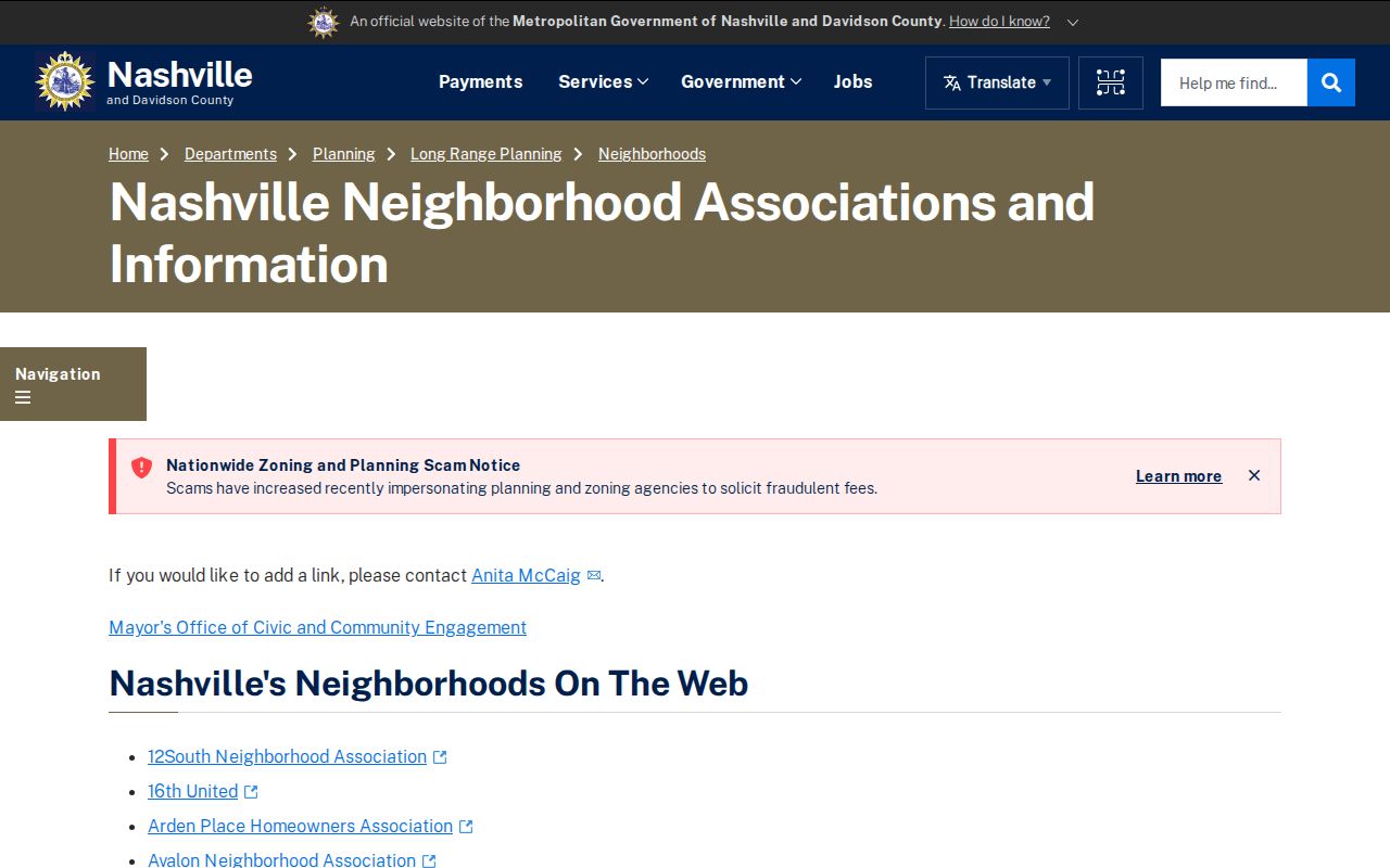
A group that posts an officer, meeting, or organization contact has supplied a public organization record. It has not supplied a list of neighbors. That distinction is especially important for HOA and civic-association pages.
Nashville Neighbors in Historic Context
When a block question reaches backward in time, Metro Archives recommends beginning with the address and moving through deeds, deed indexes, city directories, Sanborn maps, plats, Chancery material, vertical files, and cultural-resource material. Sanborn maps describe building footprints, uses, lots, and street context. They are not a current occupancy source. The Archive says it generally cannot provide a house's blueprints, permits, renovation plans, or photographs unless those items belong to a historical collection.
Address changes need their own check. Historic Preservation reports can explain a renamed street or alley, and a changed name can make a continuous property history seem to break. Compare the dated directory, historic map, plat, and deed before treating the mismatch as a move. The 1856 Davidson County fire is another series-specific research caution, not proof that all local records disappeared.
Nashville ZIP and District Boundaries Differ
ZIP code, council district, tax district, neighborhood, municipal city, and parcel situs are separate layers. Parcel Viewer can filter by ZIP and district, but a ZIP search returns parcels rather than people. The Metro ZIP layer identifies routing values and post-office labels, not a legal delivery-boundary decision. A query needs an address-level check before a postal label is treated as a local geographic claim.
Vanderbilt-associated 37232 and 37240 are strong local examples. A campus or medical routing ZIP does not establish a private residence. Central and institutional delivery areas deserve the same care. For a broader street-by-street chain after a ZIP or map result narrows the search, use the Nashville street directory route.
Nashville Neighbors Source Comparison
Official sources identify what a custodian actually holds and the date or role attached to a record. Commercial neighbor tools may combine information from many places, but their provenance, update timing, and matching method may be unclear. When a name or address matters, return to the Parcel Viewer, Assessor, Register, archive, or community source that can explain the underlying record.
For a property question, an official parcel and deed trail is more transparent. For a local-history question, an archive directory or map can show a dated presence. For a community question, a public organization contact route is the appropriate limit. Each path is more useful when its original scope is retained.
Nashville Block Records Change Over Time
Current parcel data and historic evidence answer questions on different clocks. The Parcel Viewer lists current map and ownership context, while a city directory records what its publisher printed for one year. A deed reports a recorded transaction, not necessarily a move date. An association link identifies a present public contact route, not an older neighborhood boundary. Place the date beside each record before comparing it with another source.
The Register's online name-and-date index begins July 1, 1964, yet scanned images are available from 1784 to current and archive index books are online. That split is a useful Nashville research checkpoint. For older block history, pair the current parcel with Metro Archives direct and reverse deed-index microfilm, directories, plats, and Sanborn maps instead of stopping at the modern portal boundary.
When a source is offline, use the Metro public-records request route only for an existing, identified record held by a Metro department. State the likely custodian, record type, date range, address or parcel terms, desired format, and whether inspection or copies are sought. The central route does not replace separate requests to the Register of Deeds, court clerks, Sheriff, Police, County Clerk, or Health. Metro generally responds within seven business days with production, denial, a request for clarification, or an explanation of needed time.
Keep the returned item separate from map interpretation. A record can identify an address, parcel, meeting, permit, or organization at a stated time without identifying every person connected to the block. Preserving that limit makes later corrections possible and avoids turning a neighborhood source into a personal record it was never designed to be. That is the most reliable way to keep a block-level inquiry accurate, narrow, and tied to the records actually available.
Nashville Neighbors Privacy Limits
Public sources do not authorize a targeted profile. Safe at Home participant information is confidential in voter records. Minors, protected victims, juvenile matters, sealed and expunged records, private utility data, driver-record information, and sensitive vital details have separate safeguards. A block search should never combine a name, precise home address, daily routine, family data, and contact details.
Use the source custodian for a correction. The Assessor handles assessment errors, the Register of Deeds handles record or index questions, and the Election Commission handles voter issues. The Tennessee Public Records Act opens eligible existing records to Tennessee citizens, but does not require a new neighbors list to be created.
Lawful use. Nashville neighbors sources support personal, civic, and historical research. Do not use a result to stalk, harass, intimidate, or harm another person.